Dubai Marina
Description
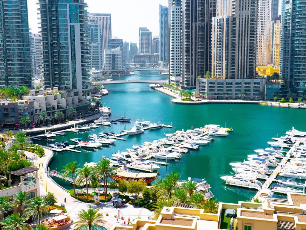
Dubai Marina is located in the western part of Dubai between Jebel Ali and Al Sufouh and includes 10 neighborhoods, the most popular of which is the Jumeirah Beach Residence complex. The author and executor of the project is Emaar Properties, which reports to the government of the emirate of Dubai. They also own such popular attractions as Burj Khalifa, Dubai Mall, Dubai Opera, Dubai Fountain and others. The district is surrounded by an artificially created harbor 3 kilometers long. That's where the name "Dubai Marina" - "yacht harbor" came from. Construction began in 2003 and has now been almost completed. Dubai Marina is planned to become the largest artificial marina for yachts, leaving behind Marina del Rey in California, USA.
District Details
- Name: Dubai Marina
- City: Dubai
- Country: United Arab Emirates
- Numeric ID: 9
- Behomes ID: 1677749183377x257418758815010300
- Coordinate Points: 32
District Center
{
"lat": 25.0795306,
"lng": 55.139403200000004
}
District Coordinates
[
{
"lat": 25.0929835,
"lng": 55.1413035
},
{
"lat": 25.0912345,
"lng": 55.1389003
},
{
"lat": 25.0921867,
"lng": 55.1371408
},
{
"lat": 25.0923033,
"lng": 55.1358533
},
{
"lat": 25.0921867,
"lng": 55.1345229
},
{
"lat": 25.0915455,
"lng": 55.1317549
},
{
"lat": 25.0894856,
"lng": 55.1287293
},
{
"lat": 25.0882224,
"lng": 55.1294589
},
{
"lat": 25.0892912,
"lng": 55.133729
},
{
"lat": 25.0883779,
"lng": 55.1353812
},
{
"lat": 25.087037,
"lng": 55.136261
},
{
"lat": 25.0803517,
"lng": 55.1325917
},
{
"lat": 25.0745601,
"lng": 55.1261115
},
{
"lat": 25.0755513,
"lng": 55.1260042
},
{
"lat": 25.0761732,
"lng": 55.1248455
},
{
"lat": 25.0799047,
"lng": 55.124824
},
{
"lat": 25.0818481,
"lng": 55.1238799
},
{
"lat": 25.083364,
"lng": 55.1219273
},
{
"lat": 25.0796715,
"lng": 55.118773
},
{
"lat": 25.0775725,
"lng": 55.1211977
},
{
"lat": 25.0753958,
"lng": 55.1235366
},
{
"lat": 25.07353,
"lng": 55.1232362
},
{
"lat": 25.0726942,
"lng": 55.1232576
},
{
"lat": 25.0718196,
"lng": 55.1237297
},
{
"lat": 25.0653473,
"lng": 55.13345
},
{
"lat": 25.0865511,
"lng": 55.1550794
},
{
"lat": 25.0914289,
"lng": 55.1490712
},
{
"lat": 25.092692,
"lng": 55.1501226
},
{
"lat": 25.094713,
"lng": 55.1477194
},
{
"lat": 25.0922839,
"lng": 55.1449084
},
{
"lat": 25.093994,
"lng": 55.1426983
},
{
"lat": 25.0929835,
"lng": 55.1413035
}
]
District Map
Map visualization will be implemented in the next phase